Rochange, the sea and the monks of Ter Doest
The history of Rockanje begins with a place that was swallowed by the sea.
- Rochange (around 1200): around 1200 a place called Rochange lay on the western tip of Voorne, which was then much larger.
- Washed away (1214): around 1214 this area was washed away in one of the floods that formed the Haringvliet.
- Monks from Flanders: with the help of Cistercian monks from the abbey of Ter Doest in Lissewege near Bruges, the land was reclaimed; the first polder was named Oud-Rockanje.
- A donation (1220): in 1220 Dirk II of Voorne gave the Middellant, as the area was called, to the monks out of gratitude; eventually nine clay polders were created, which together became Rockanje.
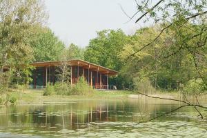
- Meertje De Waal: behind the Dorpsweg lies Meertje De Waal, a remnant of the tidal creek Strype, which formed as early as 1500 BC; between 1600 and 1900 special limestone formations, the so called growing stones, formed here.
- A puzzling name: there is no agreement on the origin of the name; it has been explained from rak, a straight stretch of river, or from the French roche for rock.
The lords of Voorne and their neighbours
Rockanje belonged to the land of the powerful lords of Voorne, with castles and fortified towns nearby.
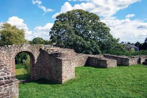
- The Castle of Voorne: in the second half of the 12th century the lords of Voorne built a castle on a raised mound in Oostvoorne to guard the mouth of the Maas; the Castle of Voorne is now a national monument.
- Jacqueline of Bavaria: in the early 15th century the castle served as a country residence for Jacqueline of Bavaria, which is why the ruin is also called the Jacobaburcht.
- Lords of Rockanje: in the 19th century the manor of Rockanje passed to the Vlielander family and, through a marriage in 1835, to the Vlielander Hein family, which still holds the title.
Village, dunes and seaside resort
For a long time Rockanje was a rural village behind the dunes, discovered in the 20th century by nature lovers and beach visitors.
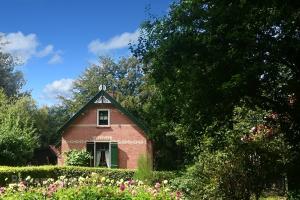
- The old dune village: at De Duinhuisjes open air museum on the Duinstraat, restored cottages show how people lived in the 19th and early 20th centuries.
- Municipality of Rockanje (1855): on 1 September 1855 the municipality of Naters was added to Rockanje, which remained an independent municipality until 1980.
- The tram that never came: the tram from Spijkenisse ran to Oostvoorne from 1906, but the planned extension to Rockanje never happened; instead a Roadrailer was bought, a bus with rail wheels.
- Voornes Duin (1927): from 1927 parts of the dunes came under the care of Natuurmonumenten; since 2008 Voornes Duin has been a Natura 2000 site.
- Racing through the village: from the late 1950s national motorcycle races were held on a dune circuit through Rockanje, with the whole village lending a hand, until speeds became too high in the early 1970s.
- Westvoorne and Voorne aan Zee: in 1980 Rockanje merged with Oostvoorne and Tinte into the municipality of Westvoorne, which became part of Voorne aan Zee in 2023.
- A changing beach: since the construction of the Second Maasvlakte, the six kilometre beach is slowly turning into a tidal flat area.